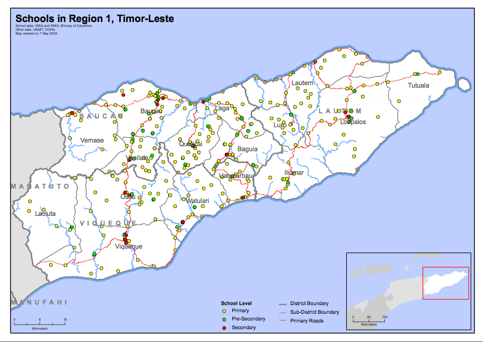
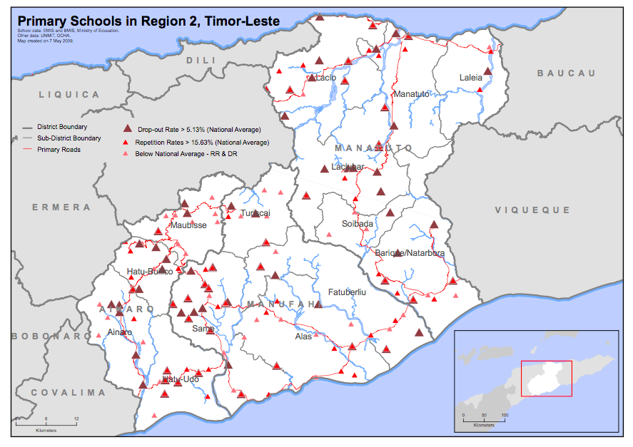
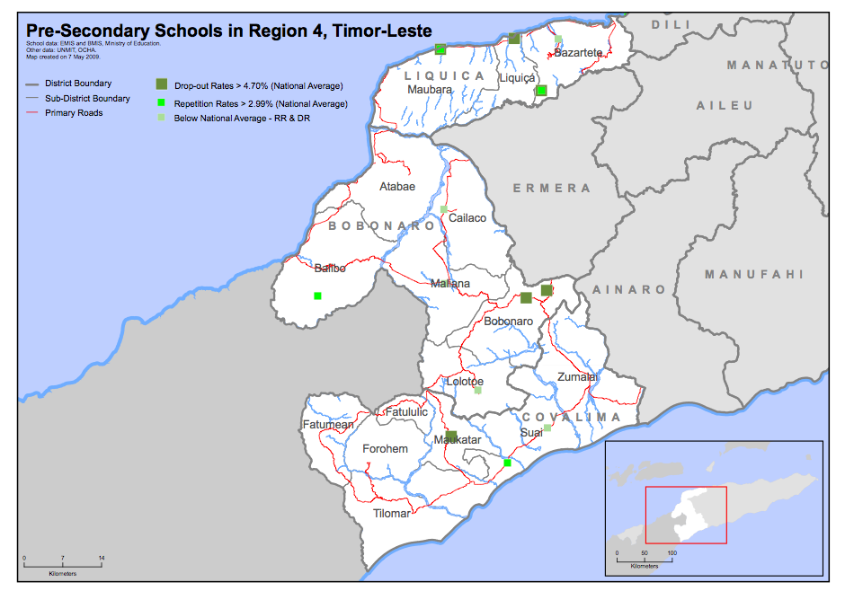
Information Design
Over 70 maps were produced at regional and district levels to show the locations of primary, pre-secondary, and secondary schools, as well the classification of the schools based on drop-out and repetition levels.

To support the development of the national strategic plan for the Ministry Education, these maps were produced for the World Bank in Timor-Leste using data collected from the government’s education management information system. Maps were incorporated into reports and wall-sized versions were used as a planning tool. Inaccurate school data was also identified through the visualization process.